A trip to Lahaina Town

Lahaina ocean front walk

Lahaina ocean front walk

Driving from Maui Vista to Lahaina Town takes about 40 minutes in light traffic. The one time home of the Ali’i (Hawaiian royalty) and port of call for whaling ships, Lahaina is now the home of restaurants, bars, souvenir shops and a port of call for cruise ships. Ticky tacky is next door to fine art; fine restaurants near national chains (think Bubba Gumps and Hard Rock Cafe). If you’re into nightlife, this is a good place to go. During the day there are people everywhere and free parking (almost) nowhere. Unless you’re lucky, you’ll pay for parking.

This single Banyan tree covers almost a whole city block

This single Banyan tree covers almost an entire city block

A not to miss sight in Lahaina is Banyan Tree Park on Front Street near the south end of “downtown.” Planted in 1873, the Banyan tree spreads by dropping new roots from ever spreading branches. Various historic sites are around the square and adjacent courthouse.

A fun place to visit with lots of choices for lunch, dinner, or a tempting gelato. Great people watching and one stop shopping for Maui souvenirs, postcards, or a big splurge.

The Hana Highway

Map to HanaSo you want to go to Hana.

It’s only 60 miles from Kihei to Hana but a round trip will take all day. Why? The last 40 some miles of the Hana Highway has over 600 curves – many of the hairpin turns – 46 one-way bridges, sometimes a lot of traffic, and many beautiful things to see along the way. Average speed is about 20 mph. That’s why it will take all day.

Tips: leave early (think sunrise) and plan on getting back after dark. (A moonlit night is nice.) Stop at lookouts and waterfalls so the driver can enjoy the trip. Share driving. If you can, spend the night in Hana or at the campground in the national park. Oh yes, if you’re prone to motion sickness, take meclizine before you go.

Ka'anae Peninsula as seen from Kaumahina Park

Ka’anae Peninsula as seen from Kaumahina State Park

The trip to Hana is about the journey, not the destination. The town of Hana is nice enough – you can get lunch there, buy some really expensive gasoline, maybe pick up a souvenir or two – but that’s not why you go to Hana. You go to Hana because of what you see along the way.

Surf off Ke'anae Peninsula

Surf off Ke’anae Peninsula

About halfway between Paia and Hana is Kaumahina State Park. It’s well signed and conspicuous on the mauka (uphill) side of the road. In addition to a fine view of Nua’ailua Bay and the Ka’anae Peninsula, it has some of the only public restrooms before you get to Hana. Two good reasons for a stop.

A side trip onto the peninsula makes a pleasant stop to admire the old stone church, stretch your legs and watch the surf.

Ching's Pool and Bridge

Ching’s Pool and Bridge

Inland from the Ka’anae Peninsula is Ching’s Pool and bridge. Very picturesque and a popular place for daredevils to jump from the bridge. The bridge is much higher than it looks in this picture and they say there are rocks in the vicinity where you might land. Jumping is NOT recommended.

Wailua Falls is a popular stop – not least because it’s right beside the road.

Wailua Falls

Wailua Falls

Past Hana is Koki Beach with a nice view of Alau Island. Once you’ve gone this far a trip to Ohe’o Gulch (aka The Seven Sacred Pools) in the Kipahulu portion of Haleakala National Park is worth the extra few miles. There’s a great hike from here too. See our post Hana – Ohe’o Gulch and the Pipiwai Trail.

Looking seaward from Ohe'o Gulch

Looking seaward from Ohe’o Gulch

Alau Island off Koki Beach Park

Alau Island off Koki Beach Park

For an alternate route to or from Hana see our post Hana – the Road Less Traveled.

Hana – the Road Less Traveled

Map to Hana - via Highway 31Many car rental companies on Maui say you can’t drive around the south side of Mt. Haleakala. Don’t believe them. There is a 10 mile stretch of well graded gravel road along the way but, unless the weather is extremely bad, any vehicle can safely travel this road. What the car companies really mean is that, if you get into trouble, they won’t come rescue you. Furthermore, since there is little or no cell phone coverage on this side of the island, if you do get into trouble, you’ll have to rely on the kindness of strangers for whatever help you might need. So there is some risk – but there’s some risk at the beach too.

A little west of the Kipahulu part of Haleakala National Park, the Hana Highway becomes Highway 31. As you travel west and turn north toward the Maui Winery at Ulupalakua it becomes Highway 37, the Kula Highway. It’s an alternate way to get to or from Hana.

Highway 31 is much different from the lush jungle-like Hana Highway. The waterfalls and hairpin corners are replaced by sweeping views of the mountain, ocean and, in the distance, Mauna Loa and Mauna Kea on the Big Island. It’s a much easier on the driver and provides an experience of Maui not everyone gets to enjoy. Consider it on your next trip to Hana.

Hole in the rock

Hole in the rock

Alpenglow on Mt Haleakala

Alpenglow on Mt Haleakala

Ranch lands on the south coast

Ranch lands on the south coast

For other posts on Hana and east Maui, see Hana – Oheo Gulch and the Pipiwai Trail and The Hana Highway.

Hana – Oheo Gulch and the Pipiwai trail

Lower pools

Lower pools

The road to Hana offers many spectacular views but much more awaits those who venture from the beaten path. If you’re going to make one long stop, consider the Pipiwai trail. The trail is a four mile round trip up the Oheo Gulch through bamboo forests past spectacular waterfalls and pools.Vertical gain to Waimoku Falls, the turn around point, is 650 feet. Allow 2+ hours – more if you like to savor the sights at a leisurely pace.

River's end

River’s end

Sometimes called The Seven Sacred Pools, the lower pools on the Oheo Gulch are a VERY popular destination about 12 miles past Hana. But there’s a lot more than seven pools and there’s nothing particularly sacred about them. The name, “Seven Sacred Pools,” is just a marketing ploy someone dreamed up a long time ago.

Shady grove

Shady grove

The well marked trail head is near the visitor center in the Kipahulu area of Haleakala National Park. A three day park pass – which is also good for the summit – is $10. Wear good shoes and carry water. Note: the river is prone to flash flooding. Don’t go if it’s raining or threatening to rain.

For the drive to Hana, see our post The Hana Highway. For driving the an alternate route to or from Hana (i.e. the south coast of Maui) see Hana – the Road Less Traveled.

Banyon tree

Banyon tree

Bamboo forest

Boardwalk through the bamboo forest

400 foot Waimoku Falls

400 foot Waimoku Falls

West Maui Snorkeling – Black Rock

Black Rock with Moloka’i in the distance

In front of the Sheraton Maui at Ka’anapoli is Black Rock, a popular and easy snorkel. Ka’anapoli Beach is a large and fabulous stretch of white sand that can be very busy in the high season when the big hotels are full. It’s worth a visit all by itself.

If the waves are calm, you can snorkel out and around the point. Strong swimmers can even snorkel north to the next beach. The best viewing, however, is on the south side and at the end of the point. There’s not much coral and, for that matter, not a lot of fish. But we’ve seen green sea turtles near the shore and multiple spotted rays at the point in beautifully clear deep water.

Black Rock with Lana’i in the distance

To get to Black Rock, take the first entrance into Ka’anapoli and continue circling to the right. Look for the small sign for Beach Access after you pass Whaler’s Village. There are two small free parking areas. The Sheraton has 20 spaces in a corner of their parking garage. Just to the south there are 10 or so outdoor parking spaces that can be reached via the next driveway to the south. Getting a parking space can be a challenge. Go early or late or around lunch when people are leaving.

Maui Brewing Company – Good Local Brews

Entry to Maui Brewing Company

Up in West Maui, just off the highway 4 miles north of Kaanapali, is the nondescript Kahana Gateway Shopping Center. Its chief distinction is being home to the only local (and quite successful!) brewery on Maui. There are lots of good beers on the island, but only those made by the Maui Brewing Company are made on Maui. And many of them are very, very good.

Founded in 2005, the Maui Brewing Company has won numerous awards for beers with names like Big Swell IPA, Bikini Blonde, and Coconut Porter. If you like beer, you’re sure to find something that fits your taste at the Maui Brewing Company. We LOVE the Coconut Porter. Check out this list.

Maui Brewing Company Beer List (September 2012)

The ABV column in this list is alcohol by volume  – a pretty objective measure. The IBU column stands for International Bittering Units – a more subjective measure of the effect of hops on beer taste. You can see the brewing vats in action. It’s very casual with lots of TV’s, all playing sports. The food is decent pub grub with efforts toward a Hawaiian twist. We enjoy the variety of sliders at just $4 or $5 each. A slider or two, a side of fries and a home-style brew is well worth our drive from Kihei to Kahana. In fact, we wear our Maui Brewing logo shirts on Wednesdays and get a $3 pint!

If you can’t make it to the brewery, or if you’d perfer a nice Hawaiian view with your suds, ask your bartender what’s on tap from the Maui Brewing Company. Lots of places carry one or more of their brews. Many grocery stores do also, but we prefer it from the tap!

For exciting news about Maui Brewing’s plan to build a brewery and pub in Kihei, click here.

Hiking La Perouse Bay – The Hoapili Trail and Cape Hanamanioa

Getting to La Perouse Bay

If you drive as far south as possible through Wailea, Makena, and beyond, you come to La Perouse Bay. The drive takes you past Big Beach, through the Ahihi Kinau Reserve, and across a long stretch of lava from the last eruption of Mount Haleakala in 1790. After the manicured beauty of Wailea, the road gets narrower. Later it gets even narrower. Finally, it gets so narrow there are pull outs so cars going in the opposite direction can pass. The last few hundred yards are so bumpy you may want to park before the last turn toward the bay. Look for the horse corral and the stone monument. You can park there or bounce over the last bumps until you get to the water’s edge. It’s about 25 minutes south of Maui Vista.

The Hoapili Trail starts a few yards from the water’s edge on your left as you face the bay. The first portion of the hike is though a lava field. This, and other parts of the trail, need real shoes, not flip flops or sandals. Tennis shoes will do, walking shoes are better.

Trail Route

There are cultural artifacts in the lava fields – the lower walls of shelters built by Hawaiians sometime after the 1790 eruption. There’s not much to see, but some people find them interesting.

Look for the a small blow hole about halfway across the lave field. If the tide is high and the surf is up it makes a good splash.

A pretty bay greats you at the end of the lava field. After that you walk under the welcome shade of mesquite trees (locally known as kiawe). Lots of feral goats here. Keep a lookout for a surfer memorial on your right after you’ve walked for 5 or 10 minutes.

As you come out from under the trees you have three choices of route. You can keep on the “road” which will take you to the next shady grove or on to your destination at the end of Cape Hanamanioa. Alternatively, you can turn off the road through the broken wire gate and follow the King’s Highway cross the second lava field until you come to a sign that tells you it was reconstructed in its present form during the first half of the 19th century. If you take this route, turn right at the sign to return to the road or to the second grove. Finally, you can walk along a very rocky beach to the second grove.

Into the woods

As indicated in the map above, once you get to the second grove, there is an easier and harder route to the end of Cape Hanamanioa. The easier route is fairly boring, with little to see but lava and views in the distance. The harder route takes you along high cliffs over sometimes rough terrain with spectacular views of the bay and beyond. The water is multi-colored shades of crystal clear blue. Sometimes the trail is hard to find. Persevere, the rough parts lead to an actual trail.

Views from the coastal trail

It’s often very windy at the end of the cape – hold onto your hat. One way distance from start to finish is about 1.25 miles. It will take you longer than you think.

From the end of the cape you can return or follow more trails (for miles) onto new coves, beaches and interesting sights. Enjoy.

Hang onto your hat at the end of the trail

Nakalele Blowhole

When exploring west Maui, consider a trip to the Nakalele Blowhole. It’s a 10 minute drive past Honolua Bay on the north shore. Look for a dirt parking lot on the ocean side of the road about a half mile past mile marker 38. If you can see a white navigation light near the shore, keep driving unless you want to take the long walk to the blowhole. A little way around the next bend is another dirt lot where the hike is much shorter.

It’s not far to the blowhole but good views can be had after a very short walk. For example, the pictures in this post were taken from a vantage point less than 100 yards from our car.

As you can see, many people hike down to the blowhole. Be advised, don’t go too close. In the summer of 2011, a young man on his honeymoon slipped on the wet rocks and was sucked into the blowhole. His body was never found. As a handmade sign we saw at the parking lot said: “This is not a water park.”

West Maui Snorkeling – Honolua Bay

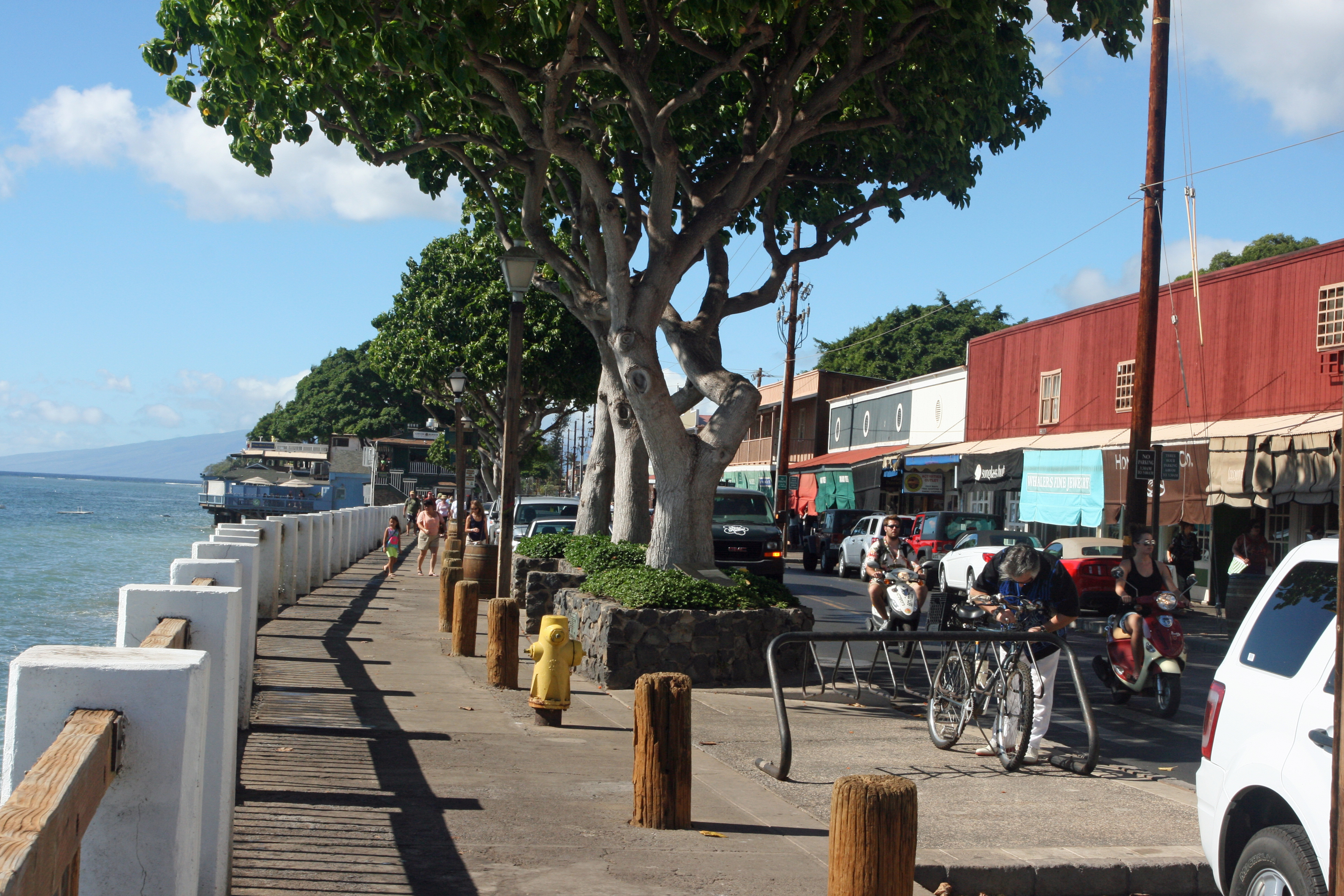
There’s so much good snorkeling not far from Maui Vista (see South Maui Snorkeling – 3 Favorite Spots), why drive an hour to Honolua Bay? There are plenty of reasons. First of all, Honolua Bay is a spectacular snorkeling spot. In addition, there are lots of other fun things to see and do in West Maui. For example, the Nakalele Blowhole is just another 10 minutes down the road past Honolua Bay.

Honolua Bay from the Highway 30 overlook

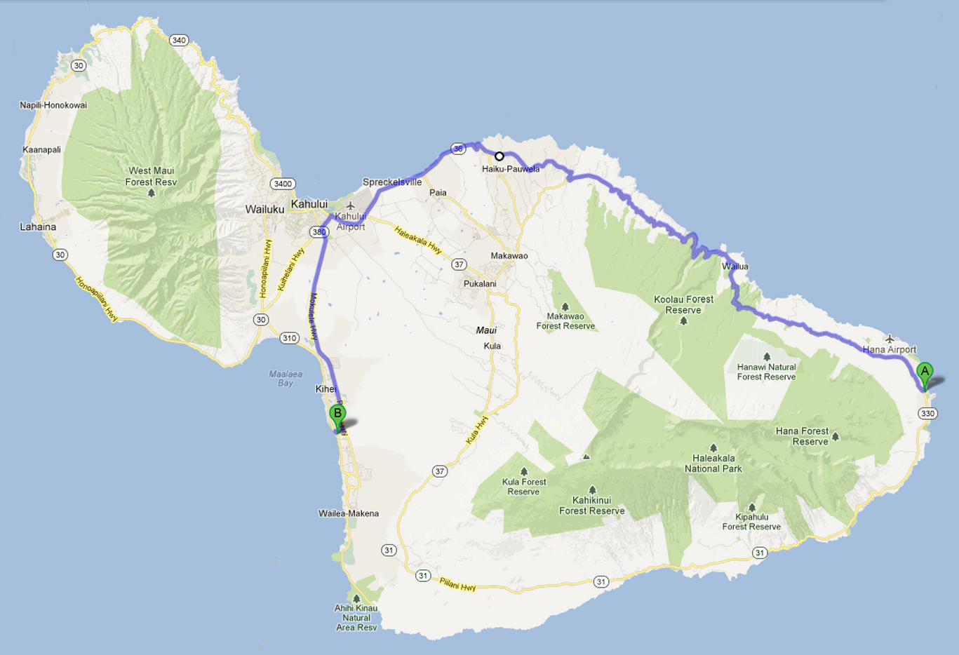
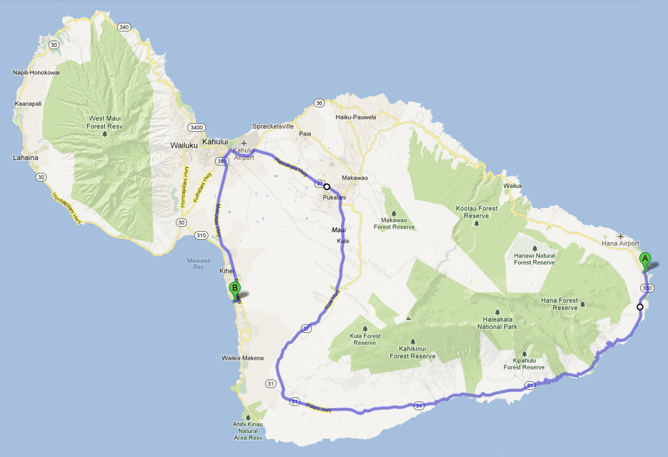
To get there from Kihei, head north on South Kihei Road or the Pi’ilani Highway and follow the signs to Lahaina. Continue north on Highway 30 through Lahaina, Ka’anapali, and Kapalua. When the road narrows and slows for tight, blind curves, you’re almost there.

Stop at the overlook (pictured above) and check out conditions and the best snorkeling spots. (If you click on the picture and blow it up you can see snorkelers and areas with coral – that’s where you want to be.) If the surf’s up, the snorkeling won’t be good – but there will be surfers to watch. You can watch from the overlook or, better still, drive around the bay and turn left onto the dirt road high on the other side side of the bay. Find a  parking spot and walk out for the best views (see Surfing the Big Water at Honolua Bay).

Trail to Honolua Bay

For snorkeling, drive to the bottom of the hill and look for a parking spot. If you don’t see one at first, keep driving – there are several other areas where people park. You’ll find a trail near each parking area. All trails end up at more or less the same place.

It’s a pleasant, but surprisingly long, walk to the water through a shaded grove. People do it in flip-flops, but a sturdier sandal or shoe is recommended.

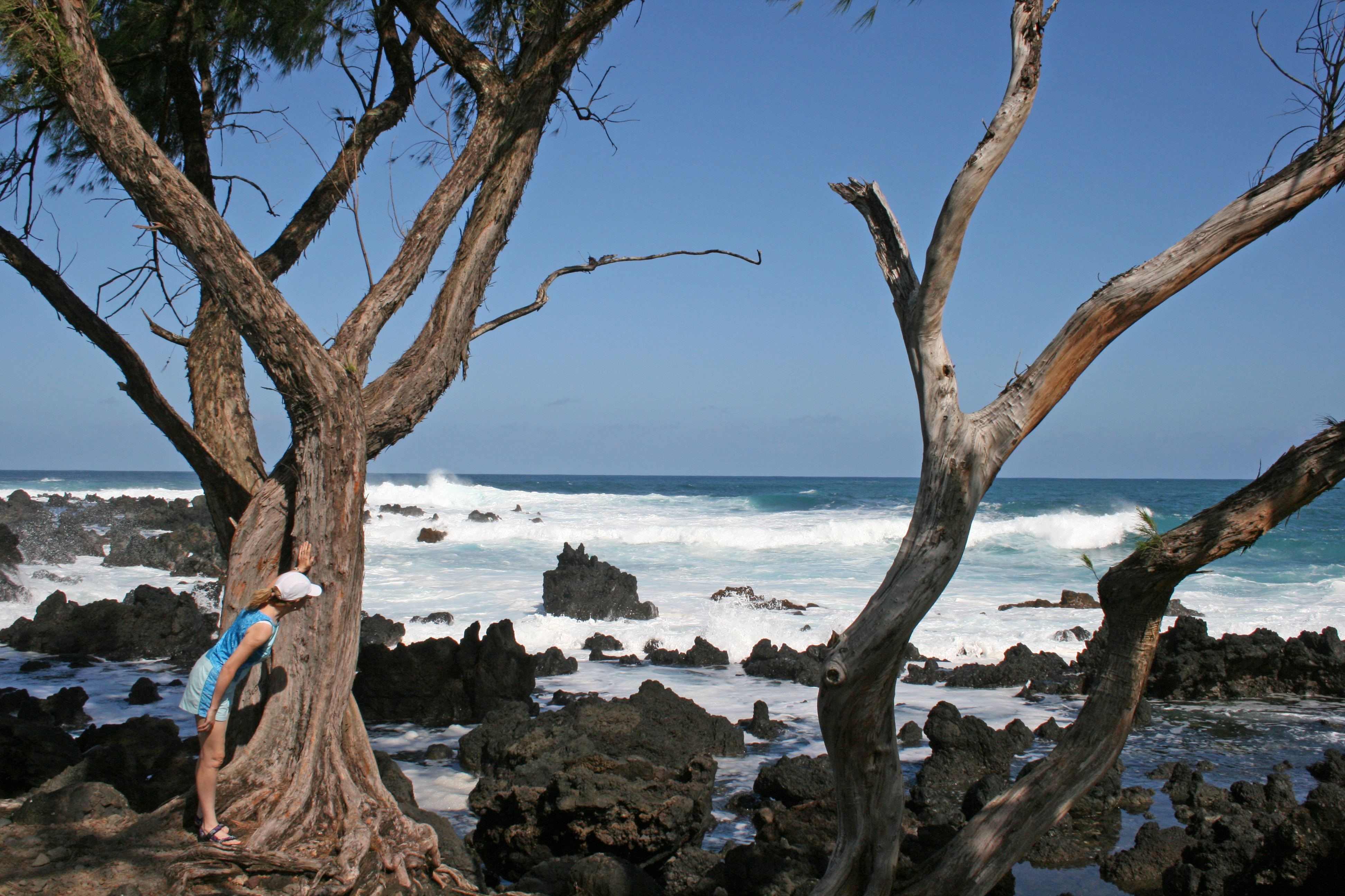
The beach itself is rocky with few places to even put a beach chair. There are no restrooms, no water, no garbage cans, no nothing – except begging chickens and great snorkeling.

The wet and sometimes slimy rocks near the shore are slippery. Lots of people get in from an old broken boat ramp that the two people on the left side of the accompanying picture are standing on.

Most people snorkel on the right side of the bay, but there is plenty of coral on the other side as well. It’s a fairly long swim before the viewing gets good. If you’re not a strong swimmer, you might want to take a boogie board or a noodle. At first the coral and fish are mainly close to the shore on the right. As the coral gets denser you’ll see it expand out toward the middle of the bay. Explore this area to your heart’s content.

A word to the wise: several large snorkel boats anchor at Honolua Bay around mid day. If you want to miss the crowd in the water, go early. If they’re there when you are, just remember that they’re paying the big bucks while you’re getting the same views for free. Enjoy!

Haleakala – Into the Crater (The Halemauu Trail)

Near the trail head

Dust in our eyes from the Sliding Sands Trail blew us off the top of Haleakala. We decided to try our luck with the Halemauu Trail.

The parking lot at the trail head is clearly marked just below the 8,000 foot level. We were greeted by a couple of overly friendly Nene. The composting toilet at the parking lot was spotless the day we were there – hand sanitizer and everything.

Approaching the crater

The first part of the hike is gently downhill through native scrub. While still a little windy, it was much more pleasant than at the top of the mountain – no dust and occasionally a little shade.

The steep part

The first approach to the crater’s edge is spectacular if somewhat daunting. The switchbacks in the photo below descend almost 1,000 feet to the valley floor. Click on the photo to enlarge and zoom in on it.

While not as common as on the Sliding Sands Trail, people ride horses up and down those switchbacks.

The round trip from the parking lot to the Holua Cabin on the valley floor is an arduous 8 miles. It can easily take 4 to 5 hours. Bring food and plenty of water. As with anywhere at higher elevations on Haleakala, bring layers of clothing. It can get very cold.

You’ll also want to bring your camera. The views of the Ko’ olua Gap and crater interior are spectacular.

For an easier hike with all sorts of amazing views, take the one mile hike to the end of the ridge jutting out into Ko’ olua Gap. We stopped there for a picnic lunch.

On top of the world

Click here to see our blog on the Sliding Sands Trail.